The marine buoy appears to be just a round ball floating on the water’s surface. However, for port operators, navigation authority agencies, offshore engineering contractors, or research institutions, it is a procurement decision that must be taken seriously. Choosing the wrong type of buoy can lead to frequent maintenance, insufficient visibility, or even affect navigation safety and trigger compliance risks.
This article starts from project requirements, systematically sorts out the main types of marine buoys, key specification parameters, material selection logic, intelligent configuration suggestions, as well as the non-negotiable compliance points during procurement, to help you find the optimal solution between budget and functionality.
Clearly Define The Requirements: What Problem Does The Buoy Need To Solve?
Before looking at any product parameters, the most important step is to clarify your project requirements. The requirements for buoys vary greatly depending on the different application scenarios:
- Mark the boundaries of the navigation channels (port entry and exit channels, river centerlines)
- Warn of underwater dangers (rocky areas, sunken ships, shoals, underwater cables)
- Provide mooring and anchoring points (for ships to dock)
- Monitor the environment and meteorology (water temperature, waves, currents, water quality data collection)
- Indicate special uses (restricted navigation zones, construction areas, breeding zones, event waters)
Due to the different types of requirements, the corresponding types, sizes and configurations of buoys are completely different. Clearly understanding this issue is the first step to avoid “paying too much” or “buying the wrong product”.
Main Types of Buoys And Their Applicable Scenarios
1. Lateral Buoys
Lateral buoys are the most common type of navigation markers, used to indicate the boundaries of the safe waterways on both sides. According to the International Association of Lighthouse Authorities (IALA) standards, the right side marker for entering the port is red and the left side marker is green – this is the globally recognized “water traffic signal”.
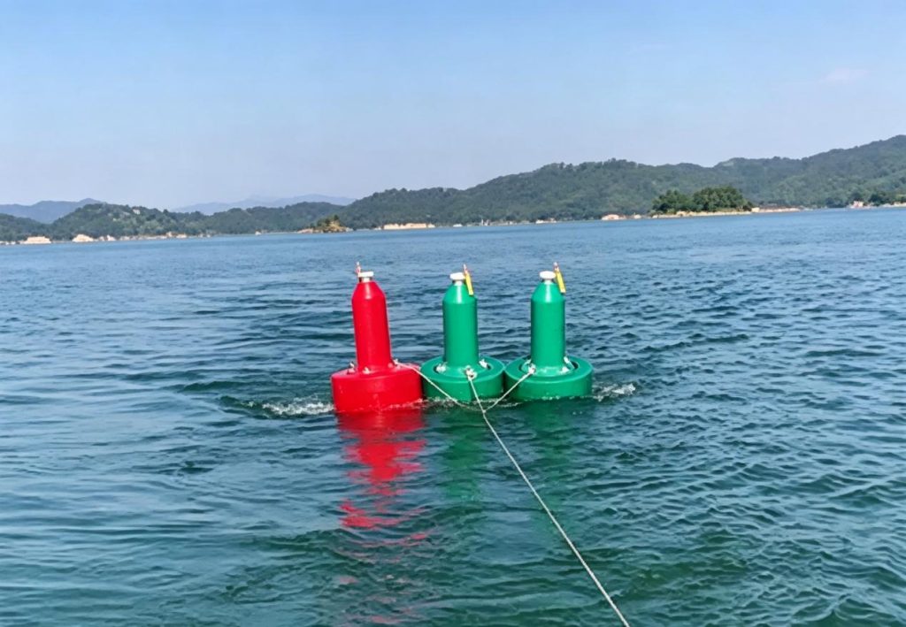
Applicable scenarios: Port entry and exit channels, estuary navigation, and main river channels of inland rivers. Side markers are the basic configuration for establishing any systematic navigation marker network.
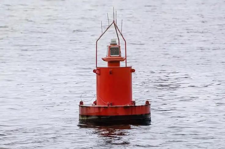
2. Safe Water Buoys
The red and white vertical striped buoys, usually large light buoys, are deployed at the entrance of the offshore area outside the port. They indicate “Ahead is safe water, feel free to enter”, and are usually the first navigational reference object that ships see before entering the port. The visibility requirement is extremely high, and the night light range must cover more than 10 nautical miles.
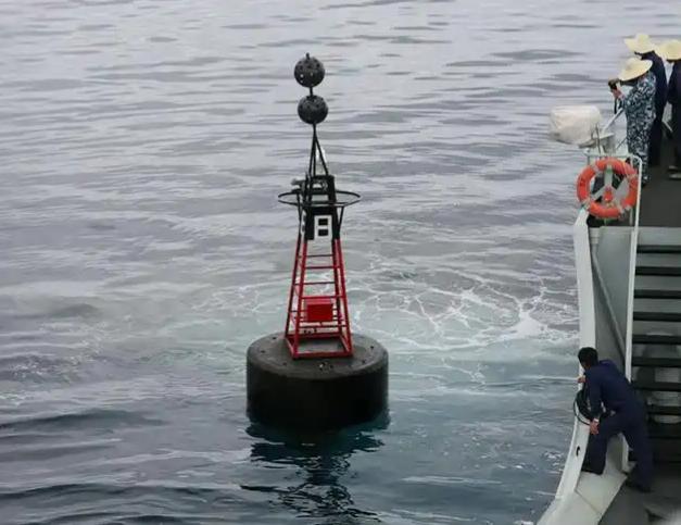
3. Isolated Danger Marks
Black and red horizontal stripes, with two black spherical top markers at the top. They are specifically deployed above reefs, sunken ships or shallow areas, and the surrounding areas are all navigable waters. For ports or waterways with potential underwater dangers, these buoys are an essential component for ensuring safe navigation.
4. Cardinal Marks
The black and yellow buoys are arranged in four directions – east, west, south, and north – indicating which direction ships should take to avoid obstacles safely. Each buoy has different light characteristics, making it easy to identify at night. They are suitable for scenarios with complex water terrain and where multiple directions are needed to indicate the location of dangerous objects.
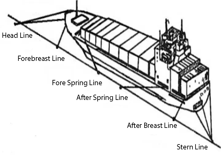
5. Mooring Buoys
These are fixed mooring points for ships, replacing anchor mooring. They are commonly found in waiting areas of harbors, yacht docks, and temporary mooring areas at sea. The core design elements of mooring buoys are buoyancy and mooring strength. The structure design needs to be based on the displacement of the largest moored vessel and the local sea conditions.
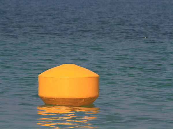
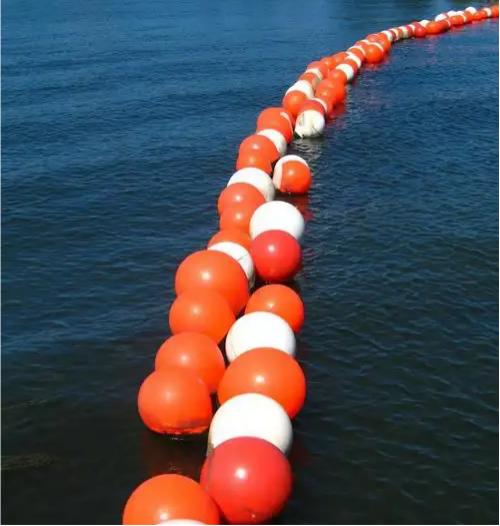
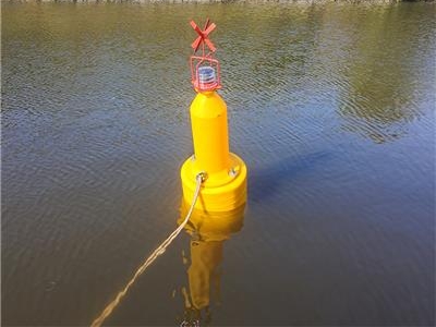
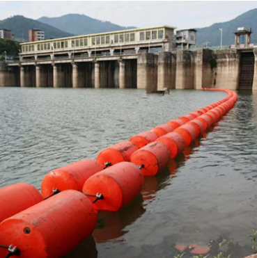
6. Special Marks
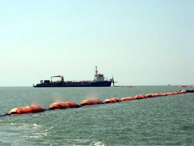
The yellow buoys are used to mark various non-dangerous specific areas: construction zones, dredging areas, aquaculture zones, pipeline routes, speed limit zones, restricted navigation zones, etc. These buoys are an important tool for the refined management of port waters.
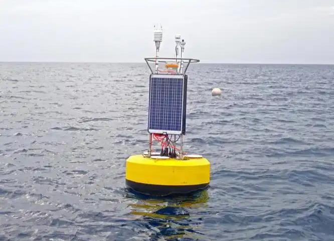
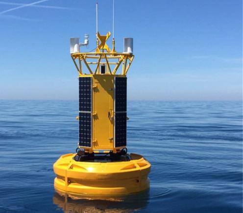
7. Data Monitoring Buoys
Intelligent buoys equipped with sensors, which collect real-time environmental data such as wind speed, wind direction, wave height, tidal current, water temperature, and salinity, and transmit the data back to the land-based platform via satellite, 4G or LoRa communication. They are widely used in port weather warning, marine engineering environmental assessment, scientific research and climate monitoring.
How to Choose The Size Specification?
The diameter of the buoy is the most direct specification indicator, which directly affects visibility, buoyancy capacity and applicable water areas.
- Small buoys (diameter 0.6–1.0 meters): Suitable for low-flow, low-wind conditions in inland rivers, harbor basins, shallow waters, and aquaculture areas. They are lightweight and flexible to deploy, and are suitable for temporary marking or scenarios requiring frequent relocation.
- Medium-sized buoys (diameter 1.0–2.0 meters): The most commonly used size in marine navigation buoys, suitable for small and medium-sized ports, nearshore channels, and estuary areas, achieving a good balance between durability and cost. Most ports’ daily channel markings use this size.
- Large buoys (diameter 2.0–4.0 meters): Used for the entrances of large ports in the open sea, areas with high visibility requirements, and near-sea environments with strong currents and large waves. They are more expensive, but their stability and light path in adverse sea conditions are significantly better than those of small buoys.
In addition to diameter, attention should also be paid to net buoyancy (the actual available buoyancy after deducting the weight), metacenter height (upright stability), and top load capacity (the remaining space for installing lights, AIS, and solar panels). These parameters are particularly important in the tender technical specifications.
Material Selection: Polyethylene or Steel?
This is the most common decision point in the procurement of buoys. Both materials have their own advantages and disadvantages, and a comprehensive judgment needs to be made based on the application environment and the total life cycle cost.
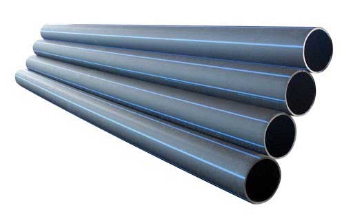
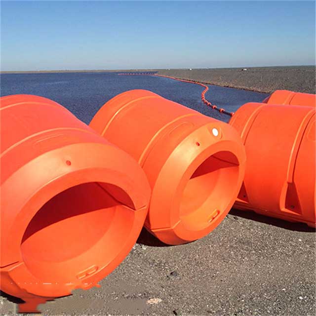
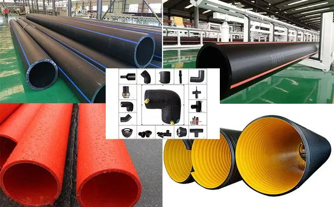
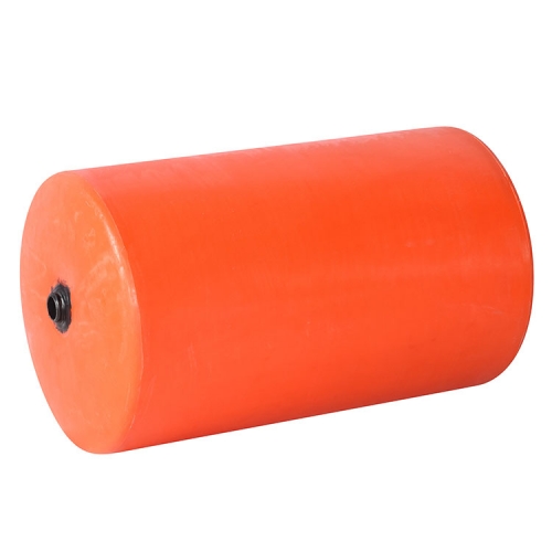
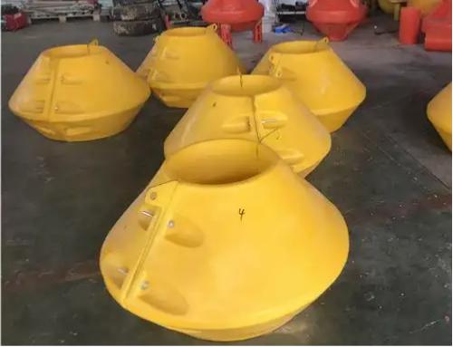
HDPE plastic buoy
High-density polyethylene (HDPE) is manufactured through the rotational molding process and is currently the mainstream material choice for newly added navigation buoys worldwide.
Advantages:
- Corrosion-resistant, no need for painting
- Long maintenance period
- Light self-weight
- Low total life cycle cost
- UV-resistant, impact-resistant
Limitations:
- In extremely deep offshore environments, the structural strength is lower than that of steel buoys
- Manufacturing of polyethylene buoys with extremely large size (diameter over 3 meters) is more difficult
Steel buoy
Advantages:
- High structural strength, suitable for large floating lights that need to carry a large amount of heavy equipment (such as high-power lamps, multi-channel sensor arrays)
- More stable performance in high-flow velocity and high-collision-risk environments (such as main channels with frequent passage of large cargo ships)
- Strong repairability, local damage can be repaired on-site with welding
Limitations:
- Requires anti-corrosion coating, high annual maintenance cost
- Heavy in weight, transportation and deployment require larger operation vessels and more manpower
- Higher initial procurement cost
Selection suggestions: For inland waterways, waters within ports, nearshore channels, and environments with moderate to low flow rates, HDPE (High-Density Polyethylene) floating buoys should be given priority; for those that need to remain in open waters with high visibility requirements for a long time, large light buoys carrying heavy equipment, or extreme near-sea deep-water environments, steel buoys should be considered.
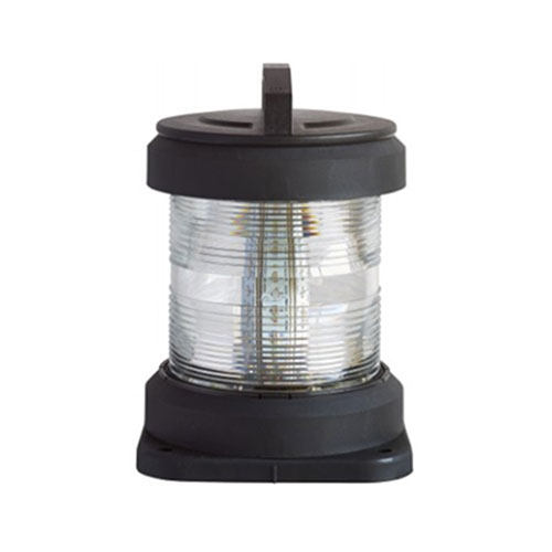
Lighting and Visibility Configuration
Visual recognition under night and low visibility conditions is one of the most crucial functions of navigation buoys.
LED lamps have completely replaced traditional bulbs and have become the standard configuration for modern navigation buoys. LEDs have the advantages of long lifespan (more than 5 years), low power consumption, pure color, and less maintenance, making them suitable for solar power supply systems.
The light range requirements vary depending on the location of the buoy: internal harbor buoys typically require 3-6 nautical miles, while entrance buoys in the open sea require more than 10 nautical miles.
GPS synchronized flashing is a practical function that enhances the system’s visibility – multiple buoys in the same navigation channel flash their lights simultaneously, enabling crew members to quickly identify the entire channel rather than identifying individual buoys one by one.
Power supply method: The combination of solar power and batteries is the mainstream solution for most buoys, requiring no external power source, is easy to install, and has low maintenance costs. For scenarios in high-latitude regions with insufficient winter sunlight, it is necessary to verify whether the battery capacity can support autonomous operation under continuous cloudy conditions.
Intelligent Configuration: When is AIS Integration Necessary?
Traditional buoys only provide visual markings. Modern intelligent navigation aids (Smart AtoN) have added digital communication capabilities on this basis.
AIS AtoN Transmitter: The buoy transmits its precise GPS location via AIS. The ECDIS (Electronic Chart Display and Information System) on the ship can receive and display the buoy’s position in real time. This means that even in conditions of poor visibility such as heavy fog or heavy rainfall, crew members can still use the electronic chart to determine the buoy’s location. At the same time, AIS continuously sends information about the status of the lights to the shore base station. Operators can monitor in real time whether each buoy is in place and whether the lights are functioning properly without having to send out a vessel.
Scenarios suitable for introducing AIS integration:
- Large commercial ports, passenger ports, with high vessel traffic
- Waters where visibility is frequently affected by fog or precipitation
- Desiring to establish a remote monitoring and management platform for buoys to reduce the frequency of manual inspections
- Port VTS (Vessel Traffic Management System) needs to be linked with buoy data
Monitoring sensor configuration: If the project also involves marine environment monitoring, wind speed and direction meters, wave sensors, ADCP, water quality sensors, etc., can be integrated onto the buoy. The data is uploaded to the cloud platform in real time via satellite or 4G.
Virtual AtoN: A digital navigation supplementary method that has emerged in recent years – without the need for physical buoys, virtual marker information is directly broadcast via AIS to all ships’ ECDIS within the area. It is suitable for temporary marking or in extreme environments where physical buoys are difficult to deploy. When used in conjunction with physical buoys, it can form a more complete safety guarantee system.
Compliance Key Points: Standards that Must be Confirmed Before Procurement
Ignoring compliance requirements is one of the most common risks in the procurement of marine buoys, which may result in the products failing to pass the acceptance inspection and causing safety hazards in international shipping.
IALA Zone Confirmation: The world is divided into two buoy color systems, Zone A (Europe, Africa, Asia, Oceania) and Zone B (America, Japan, South Korea and some other regions). The meanings of the red and green colors of the side markers are exactly opposite in the two zones. Before procurement, it is essential to confirm the IALA zone applicable to the water area where the project is located.
Main reference standards:
- IALA Guideline No. 1006: Design Guidelines for Plastic Markers
- IALA Guideline No. 1066: Design Specifications for Mooring of Floating Navigation Aids
- IALA Recommendation E-107: Specifications for Mooring of Floating Navigation Aids
- IALA Guideline No. 1077: Maintenance Guidelines for Navigation Equipment
AIS equipment certification: The intelligent buoys equipped with AIS transponders should obtain the relevant IALA certification (in compliance with IALA A-124, A-126 standards) to ensure that the signals conform to international norms.
Choose the Right Marine Buoys for Your Project
Selecting the right marine buoy is essentially a four-dimensional balance decision-making process of “demand – environment – cost – compliance”. No buoy is universally optimal – the demands of small inland ports and large commercial deep-water ports are vastly different, as are the requirements of quiet yacht berths and strong current offshore areas.
Invest time in completing the preliminary demand analysis, clearly defining the application scenarios and technical specifications, confirming compliance requirements in accordance with IALA standards, and then making material and configuration choices based on the full life cycle cost (rather than merely comparing the purchase unit price) – this is the correct path to reduce project risks and achieve the best long-term returns.